
A “casual tip” led archaeologist Michael Frachetti to the discovery of “Tugunbulak, an enormous fortified city dating back to a medieval empire. He and his team would spend nearly a decade trying to map out the site, as well as the one he’d originally come to Uzbekistan to explore, known as Tashbulak.”
Frachetti is a Professor of Archaeology at Washington University in St. Louis and he has been leading a team of archaeologists working on urban sites in central Eurasia that were part of the caravan trading networks often referred to as the Silk Road.
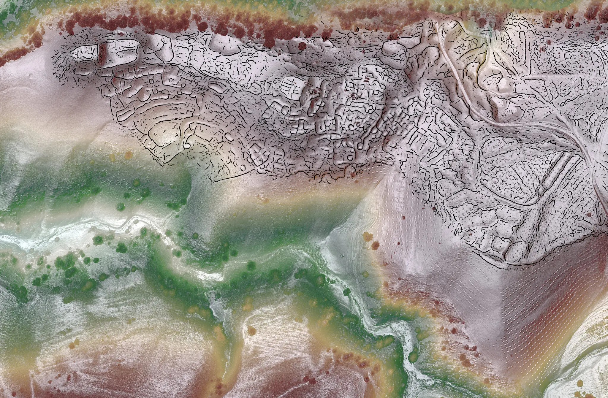
The team has also used drones to produce aerial maps of these Eurasian cities on the Silk Road.
“The results of their research, published on Wednesday in the scientific journal Nature, describe the two sites as ‘the largest and most comprehensive urban plans of any medieval city’ in Central Asia situated at high altitude (defined here as about 6,500 feet above sea level).”
The size of the cities and the evidence of their robust commercial activity suggests that mountainous regions were integrated in the caravan trading networks of the Silk Road.
“The findings complicate the prevailing image of the Silk Road, which facilitated the exchange of goods and ideas between people from China to Venice between the second century B.C. and the 15th century A.D. Many experts had previously thought that the famous trade route passed only through the lowlands.”
Students in HIST 110 History of the Western World I at Northern Illinois University will be interested in this research.
The New York Times reports on the recent research on Eurasian cities and the Silk Road.
