
Digital scanning and mapping techniques are being used to (re)discover archaeological sites around the world.
One of the latest digital mapping project involves the city of Salisbury in England. The medieval city there was located at a site called Old Sarum, about two miles from the modern city of Salisbury.
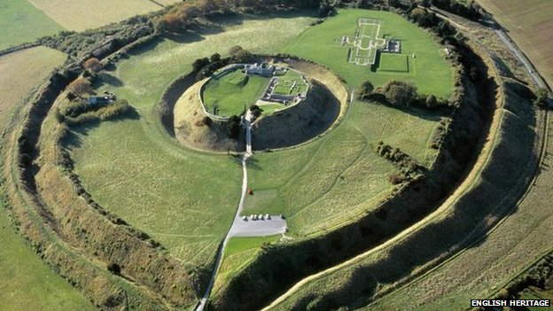
The site of Old Sarum appears today as a ruined hilltop bailey.
With new research tools, a very different understanding of Old Sarum emerges.
“A detailed plan of a medieval city has been produced by experts without any digging at the site,” according to the BBC. “The latest scanning techniques were used to uncover a network of buildings at the 11th Century Old Sarum near Salisbury in Wiltshire. The results include a series of large structures, possibly defences, with open areas of ground behind possibly for mustering resources or people.”

Digital mapping projects like this are changing our understandings of archaeological sites, archaeological methods, urban history, and the history of war, culture, and society.
The BBC reports on the mapping of Old Sarum.
