
The City of Rio de Janeiro has been located near the Golden Gate into San Francisco Bay. NOAA researchers recently utilized sonor mapping techniques to survey the ocean floor around the entry to the San Francisco Bay, finding the site of this famous shipwreck.
According to Wired, “At 5:30 am on February 22, 1901, the iron-hulled City of Rio de Janeiro, enveloped in fog, hit the rocks of Fort Point just within the Golden Gate. Water flooded the bulkheads, sinking the ship within 10 minutes and killing 128 of the 210 passengers aboard, most of them Chinese and Japanese emigrants. Captain William Ward, who died, and Pilot Frederick Jordan, who lived, were found guilty of gross negligence because they never should have attempted to enter San Francisco Bay.”
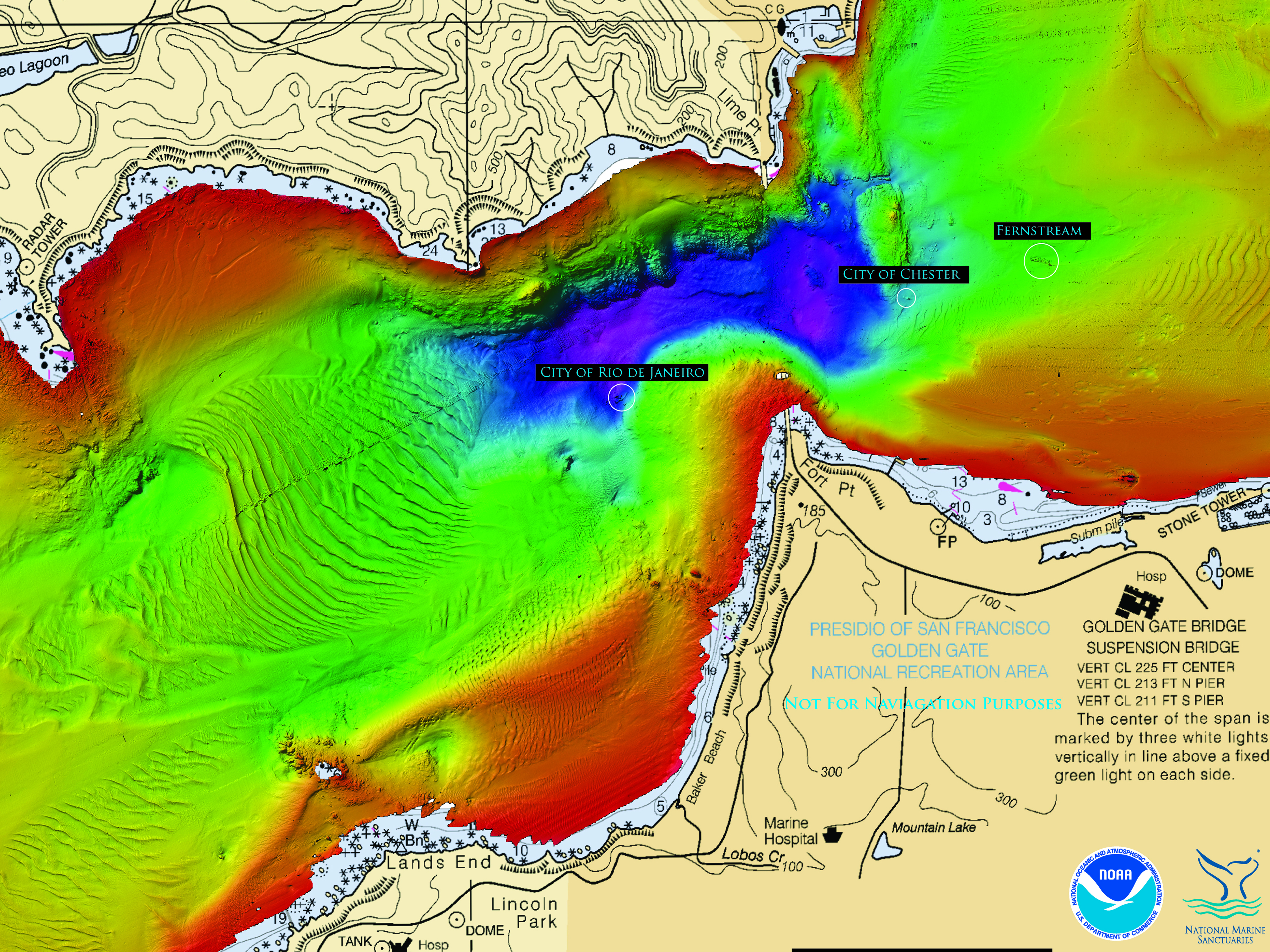
The digital survey has produced detailed maps, locating several major shipwrecks in the area.
Wired reports on the digital mapping project.
Historians working with digital humanities projects and transoceanic history will be interested in the potential of the mapping techniques used by the NOAA team.
