
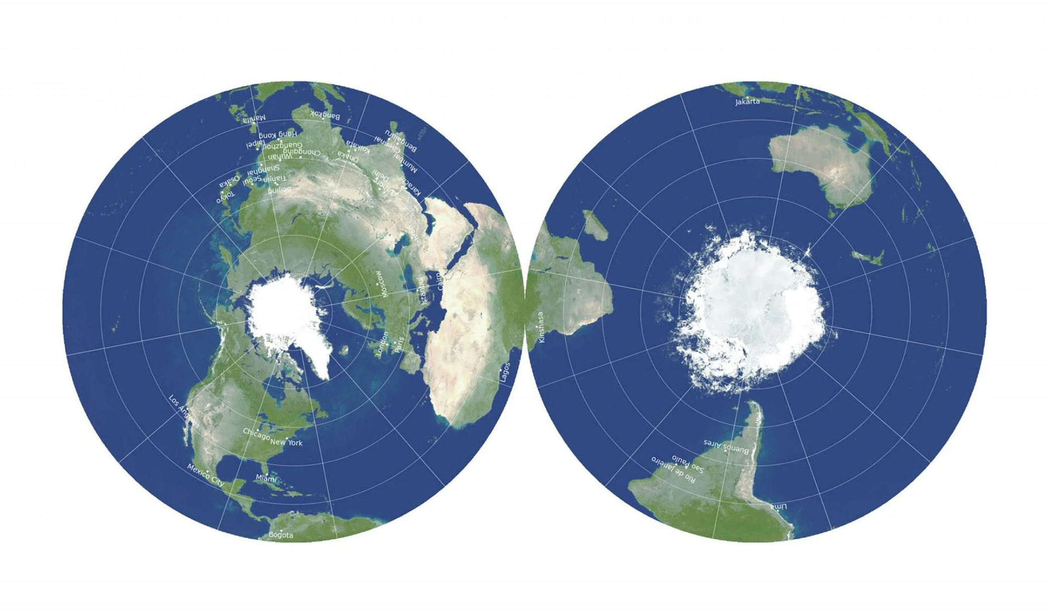
A new world map may transform the way we look at the earth. This map is a two-dimensional double-sided disk centered on the earth’s poles.
Major innovations in the history of cartography are difficult to achieve, despite new digital tools such as Geographic Information System (GIS) mapping. The New York Times reports that “Most of the world maps you’ve seen in your life are past their prime. The Mercator was devised by a Flemish cartographer in 1569. The Winkel Tripel, the map style favored by National Geographic, dates to 1921. And the Dymaxion map, hyped by the architect Buckminster Fuller, debuted in a 1943 issue of Life.”
“Enter a brash new world map vying for global domination. Like sports, the mapmaking game can sometimes grow stale when top competitors are stuck on the same old strategy, said J. Richard Gott, an astrophysicist at Princeton who had previously mapped the entire universe. But then along comes an innovator,” according to The New York Times.
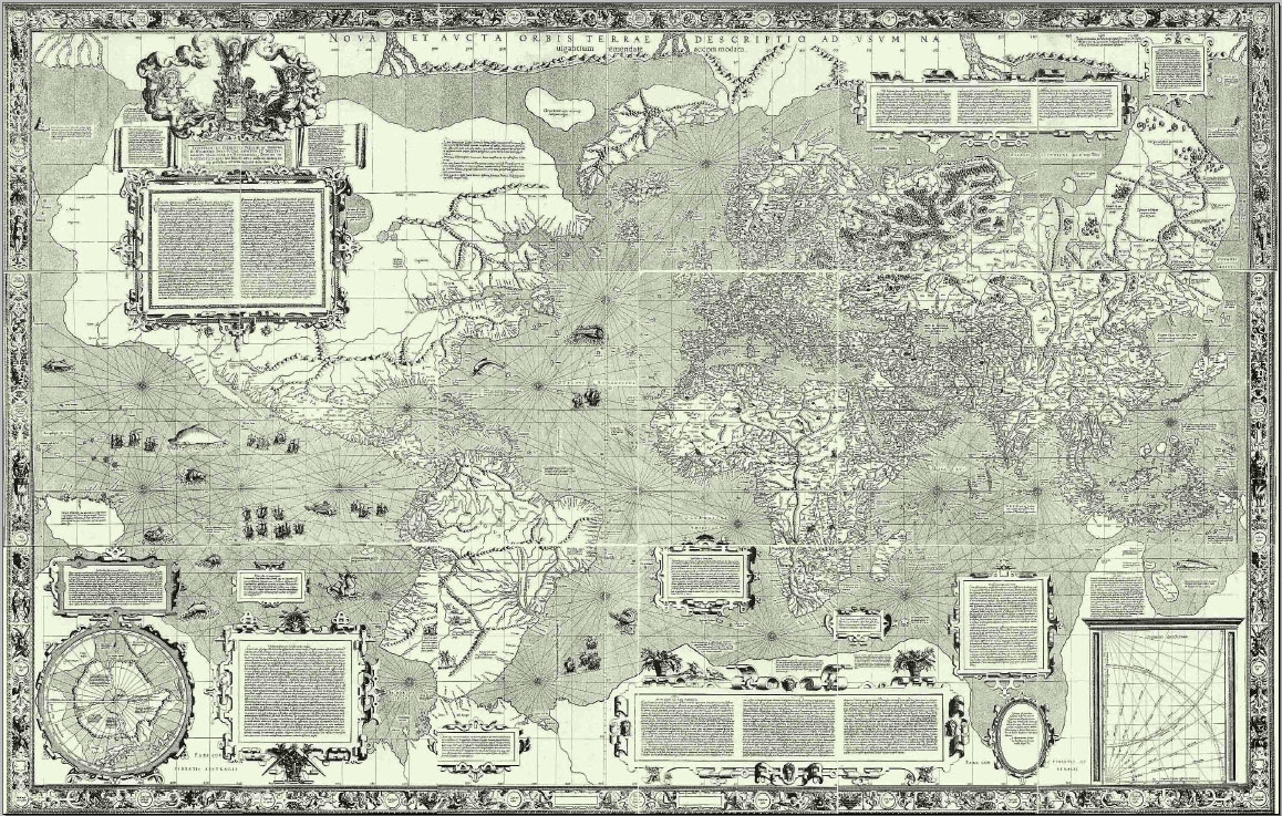
This world map presents a perspective of the globe that is radically different from the classic Mercator projection, which was developed by geographer and cartographer Gerardus Mercator in 1569. Mercator’s projection relies on straight rhumb lines and perpendicular intersections of parallels and meridians, making it practical for maritime navigation.
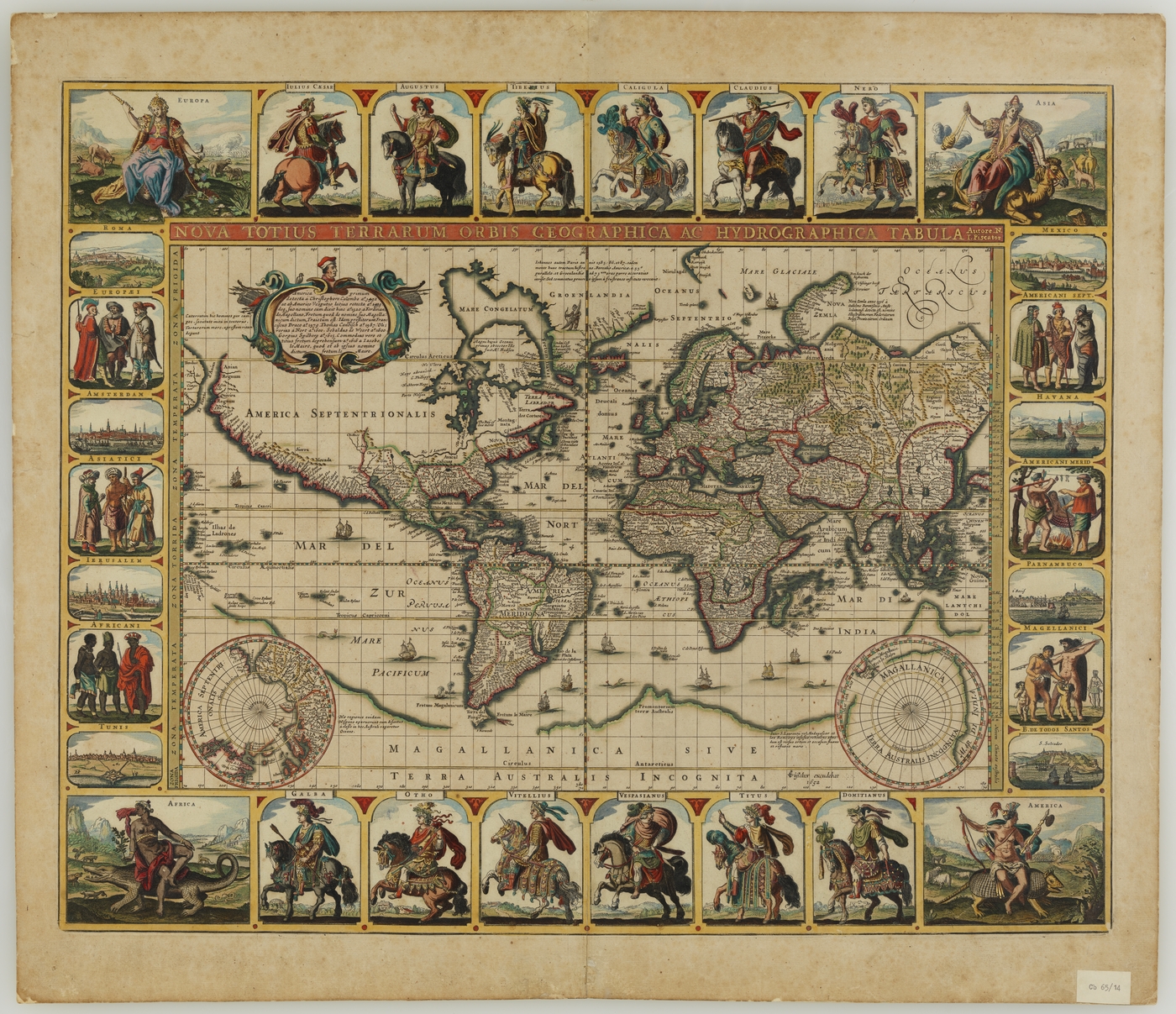
The Mercator projection also became very popular for prestige world maps that showcased empires, kingdoms, and cultures around the world. This map by Claes Jansz Visscher shows how elaborate such prestige world maps became by the mid-seventeenth century.
New South Wales State Library
Although competing cartographic solutions to mapping the world have challenged the prominence of Mercator’s world map, his projection is still used in many academic works and news publications today. So, the new double-sided disk map is a welcome development in the history of cartography.
The New York Times reports on the new double-sided disk map.
