
The Stonehenge Hidden Landscape Project is conducting a massive digital mapping effort to construct an archaeological study of Stonehenge and nearby ritual sites.
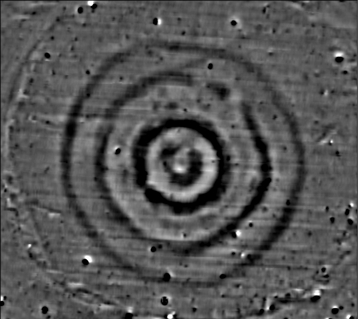
This major Digital Humanities (DH) project is sponsored by the University of Birmingham and the Ludwig Boltzmann Institute for Archaeological Prospection and Virtual Archaeology. Project members have conducted digital mapping of Stonehenge and the surrounding area using “magnetometer measurements and ground penetrating radar surveys.”
Similar methods are being used currently to construct digital maps of First World War trench systems.
The Stonehenge Hidden Landscape Project has now released their initial findings, which have been featured in a BBC Two documentary.
The Stonehenge Hidden Landscape Project website has detailed information and links. Researchers and students working on DH projects and GIS mapping techniques will be interested in this project.
